Find Where a Photo Was Taken using AI.
GeoRevelo is the premier visual intelligence platform. It reads pixels, identifies signals, and returns actionable location leads in seconds—zero metadata required.
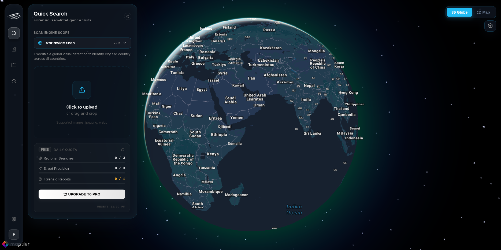

Upload any photo in the workspace — no EXIF data needed.
No EXIF metadata required — a single photograph is enough to reconstruct location coordinates.
OSINT Image Geolocation: From one photo to a pinpointed address.
A walkthrough of the GeoRevelo workflow — narrowing a single image from a region to an exact street. No metadata, no landmarks.
Built for low-context images.
Street Targeting delivers meter-level precision even when clear landmarks are absent, narrowing broad regions to exact locations in seconds.

Refines a low-context image into a precise, real-world location using visual signal alignment.
Advanced Case Management.
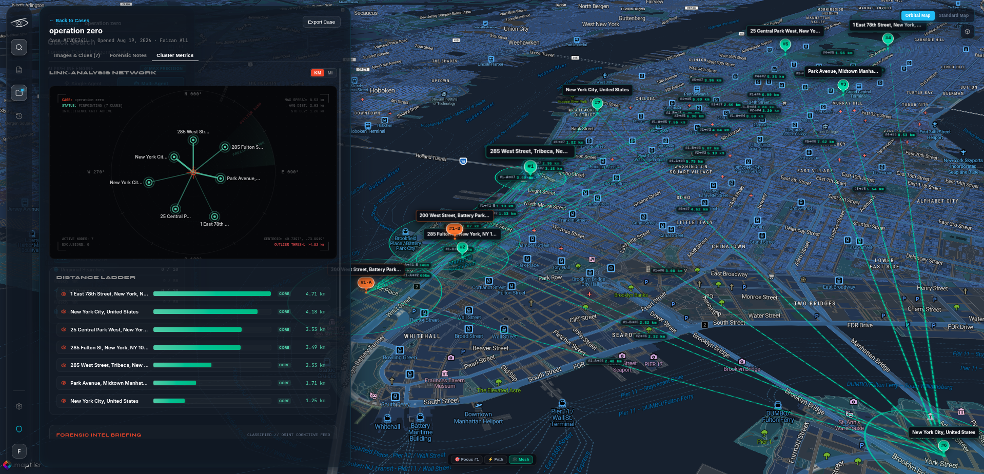
Organize complex operations with our intuitive case dashboard. Visualize intelligence through link-analysis networks, distance ladders, and multi-agent reasoning—all seamlessly integrated into one command center.
Multi-Agent AI Network.
Cross-Referenced Intelligence. Our architecture doesn't just guess. Multiple proprietary, sandboxed neural nodes process encrypted inputs concurrently to deliver high-confidence, court-ready data without revealing source methodologies.
Visual Pattern Agent
Performs initial high-dimensional feature extraction for architectural and landscape patterns.
OCR & Signage Agent
Conducts deep-layer semantic analysis and localized text extraction from raw pixels.
Geo Context Agent
Correlates isolated variables against global topological and geospatial graphs.
Synthesis Engine
A master arbitrator synthesizes all agent outputs to eliminate false positives and pinpoint locations.
Transparent, Mission-Ready Pricing
Scale your visual intelligence capabilities from solo OSINT research to enterprise defense operations.
Free
Ideal for OSINT hobbyists & basic geolocation.
- 3 Regional Geolocation Scans / day
- 2 Street-Level Pinpoint Scans / day
- 1 Forensic Intelligence Report / day
- 2D OpenStreetMap triangulation
- Standard processing queue
- Public community support
Pro
For active investigators and security researchers.
- 10 Regional Geolocation Scans / day
- 10 Street-Level Pinpoint Scans / day
- 5 Forensic Intelligence Reports / day
- Interactive 3D MapTiler Globe rendering
- Deep clue analysis (Sun angle, foliage, signage)
- Classified case log directory & tag overrides
- Multi-agent AI cross-verification pipeline
Premium
For professional OSINT teams & advanced analysts.
- 30 Regional Geolocation Scans / day
- 30 Street-Level Pinpoint Scans / day
- 15 Forensic Intelligence Reports / day
- Interactive 3D MapTiler Globe rendering
- Deep clue analysis (Sun angle, foliage, signage)
- Classified case log directory & tag overrides
- Multi-agent AI cross-verification pipeline
Calculate Monthly Needs
Estimate your monthly volume
All plans include a 14-day cancel-anytime policy · No hidden fees
Everything You Need to Know
Got questions about GeoRevelo's underlying neural technology, privacy standards, or enterprise deployment models?
GeoRevelo uses multimodal deep neural networks trained on global visual terrain datasets. It extracts pixel-level clues — such as sun elevation angle, vegetation and soil profiles, road marking patterns, architectural styles, utility infrastructure, and signage scripts — and cross-references them against global topological maps.
Our models evaluate over 40 distinct environmental and human-made indicators, including solar zenith angles, biome types, tree species distribution, license plate geometry, phone number formats, building materials, and power line tower structural designs.
Free Tier accounts receive complimentary monthly clue scans with basic coordinate estimates. Pro Analyst subscribers unlock unlimited scans, multi-agent AI reasoning, sub-meter geolocation resolution, batch image processing, and priority GPU inference routing.
No. GeoRevelo is built with a strict Zero-Trust Operational Security model. Uploaded imagery is processed ephemerally in RAM during the neural inference pass and is immediately purged upon response delivery unless explicitly saved to your encrypted workspace.
Average scan speeds range between 1.8 to 2.8 seconds per query image. Confidence ratings are provided alongside coordinate bounding clusters, giving exact probability circles across street-level, city-level, and regional bounds.
Yes. Enterprise Defense customers can deploy GeoRevelo as a containerized enclave inside private cloud VPCs, air-gapped defense networks, or localized data centers with custom RBAC and SAML/SSO integration.
Yes. GeoRevelo generates standardized, court-ready and editorial-ready forensic dossiers in PDF and JSON formats, complete with confidence scores, coordinate clusters, sun angle estimations, and match matrices.
Yes. All Pro Analyst and Enterprise accounts have programmatic REST API access with custom webhooks, client libraries in Python and TypeScript, and OpenAPI v3 documentation.
Still have unanswered questions?
Our geospatial intelligence specialists and technical support engineers are available 24/7.